Eyes Over the Equator: How UAE Satellite Networks Are Redefining Climate Intelligence Beyond the West
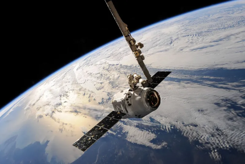
For decades, the architecture of global climate monitoring has been largely a Western enterprise. American agencies and European consortiums have dominated the orbital infrastructure that tracks sea-level rise, desertification, and atmospheric carbon. That architecture is shifting. From launch facilities in Kazakhstan to ground stations nestled at the edge of the Arabian Desert, the United Arab Emirates is assembling a geospatial capability that is not merely catching up to its Western counterparts — in several critical dimensions, it is moving ahead of them.
The implications extend far beyond the Gulf. For researchers, policymakers, and agribusinesses in the United States, understanding who controls Earth observation data — and how that data is processed, shared, and monetized — is becoming one of the defining strategic questions of the decade.
A Constellation Built for a Warming World
The UAE's space ambitions have often been framed through the lens of prestige: the Hope Probe to Mars, the Astronaut Program, the gleaming headquarters of the Mohammed Bin Rashid Space Centre in Dubai. But the more consequential story may be the quieter one — the steady accumulation of low-Earth-orbit observation satellites purpose-built for environmental intelligence.
The KhalifaSat satellite, entirely designed and assembled by Emirati engineers, delivers sub-meter resolution imagery capable of detecting changes in coastal mangroves, urban heat islands, and agricultural land use across a swath of territory that spans from sub-Saharan Africa to South and Southeast Asia. More recently, the UAE has invested in hyperspectral imaging payloads that can analyze soil moisture, vegetation health indices, and atmospheric particulates with a granularity that older multispectral systems simply cannot match.
Critically, the UAE has structured data-sharing agreements with dozens of nations across the Global South — countries that have historically been consumers of Western-produced satellite data rather than partners in its production. This is not philanthropy. It is a deliberate geopolitical strategy, and it is working.
Where Western Platforms Are Falling Short
To be clear, American and European Earth observation programs remain formidable. NASA's Landsat series and the European Space Agency's Copernicus constellation produce enormous volumes of open-access data that researchers worldwide depend upon. But open-access data has a latency problem. By the time raw satellite imagery is processed, validated, and released through public portals, days or even weeks may have elapsed — a critical gap when the goal is real-time monitoring of a flooding river delta or a rapidly expanding drought zone.
UAE-backed geospatial platforms, including proprietary analytics layers built atop satellite feeds, have prioritized near-real-time delivery as a core product feature rather than an optional upgrade. For agricultural ministries in East Africa or water resource agencies in South Asia, that difference in speed is not marginal — it is operationally decisive.
There is also a customization dimension that Western platforms have struggled to address. Large institutional providers tend to offer standardized data products calibrated for temperate-zone conditions — soil classification systems, vegetation indices, and precipitation models that perform well in Iowa or Normandy but require significant recalibration for the arid and semi-arid environments that cover much of Africa and Asia. UAE geospatial firms, operating from one of the world's most data-rich arid environments, have built their analytical frameworks around these conditions from the ground up.
The Geopolitical Dimension of Map-Making
Control over mapping infrastructure has always carried political weight. Colonial-era cartography was explicitly an instrument of power. The digital equivalent is subtler but no less consequential. When a government's understanding of its own territory — its agricultural productivity, its water reserves, its urban growth patterns — depends on data platforms controlled by foreign entities, that government's sovereignty is, in a meaningful sense, incomplete.
The UAE has been explicit about positioning its geospatial capabilities as a tool of South-South cooperation, offering partner nations data sovereignty over their own environmental information in ways that Western providers often cannot or will not. This framing resonates powerfully across regions where historical grievances about data colonialism remain politically potent.
For American technology companies and government agencies accustomed to operating as the default providers of geospatial infrastructure, this shift demands serious attention. The assumption that the United States will remain the indispensable partner in global mapping is no longer safe.
What This Means for American Stakeholders
U.S. agribusinesses with operations in Africa or South Asia are already encountering UAE-built geospatial platforms in the field, often without fully recognizing their origin. Agricultural intelligence tools that integrate satellite imagery, predictive analytics, and on-the-ground sensor networks are increasingly sourced from Gulf-based providers who have established regional data partnerships that American competitors lack.
For climate researchers, the emergence of non-Western satellite networks creates both opportunity and complexity. More orbital assets means more data — but it also means navigating a more fragmented landscape of data standards, access protocols, and licensing agreements. Academic institutions and federal agencies will need to develop new frameworks for incorporating UAE-sourced environmental data into their modeling pipelines.
And for policymakers, the question is starker still: as the UAE's geospatial constellation grows, and as its data-sharing agreements with non-Western nations deepen, the United States faces a genuine strategic choice about whether to engage with this emerging infrastructure as a partner, a competitor, or something more ambiguous in between.
The Road Ahead
The UAE's trajectory in Earth observation is not a temporary disruption. It reflects sustained investment, deliberate capacity-building, and a coherent long-term vision for geospatial leadership. The desert, it turns out, is an excellent vantage point from which to watch the rest of the world — and the Emirates has been watching carefully.
For those of us tracking the intersection of geospatial technology and global power, the lesson is clear: the map of who makes the maps is being redrawn, and the new cartographers are not always who we expected them to be.