Beneath the Surface: How Dubai's Geospatial Nervous System Powers the World's Most Ambitious Smart City

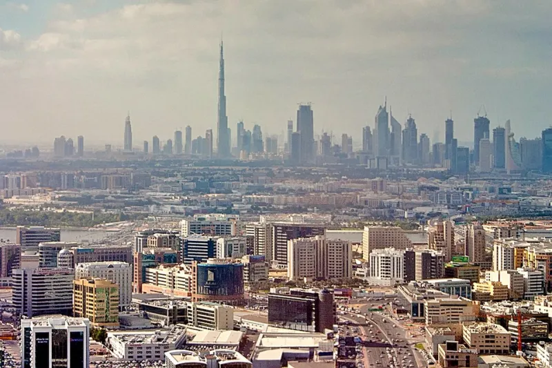
Photo: Dafifalo, CC BY 4.0, via Wikimedia Commons
Visitors to Dubai tend to focus on what is visible: the soaring towers, the immaculate highways, the driverless metro gliding silently between stations. What receives far less attention is the invisible architecture that makes all of it function—a layered geospatial intelligence platform that continuously ingests, processes, and acts upon spatial data at a scale and speed that few cities anywhere on earth have achieved.
For American municipal planners, technology officers, and GIS professionals, Dubai's approach to urban geospatial systems is worth studying carefully. Not because it can be transplanted wholesale into a US context—the governance structures and funding mechanisms are fundamentally different—but because it demonstrates what becomes possible when location intelligence is treated as critical infrastructure rather than an administrative support tool.
The Architecture of Awareness
At its core, Dubai's smart city geospatial framework operates through what the emirate's technology administrators describe as a unified spatial data platform—a centralized repository that aggregates inputs from thousands of sensor nodes, satellite feeds, drone surveillance networks, and municipal information systems into a continuously updated three-dimensional model of the city.
This is not simply a GIS database in the conventional sense. The platform incorporates temporal dimensions, tracking how spaces change across hours, days, and seasons. It integrates semantic layers—understanding not just where a building is, but what it is used for, how many people typically occupy it at different times, and how its function relates to surrounding parcels. The result is something closer to a living digital twin of Dubai than a static map.
The technical stack supporting this architecture combines open-standard GIS formats with proprietary data fusion middleware developed in partnership with several international technology providers. Real-time data streams are processed through edge computing nodes distributed across the city, reducing latency for time-sensitive applications such as emergency response routing and traffic signal optimization.
Autonomous Mobility and the Spatial Precision It Demands
Dubai's commitment to autonomous vehicle deployment—the emirate has set targets for a substantial percentage of all transportation to be driverless by the early 2030s—places extraordinary demands on its geospatial infrastructure. Autonomous systems require centimeter-accurate HD maps, continuously updated to reflect construction changes, temporary road closures, and environmental conditions.
The Dubai Roads and Transport Authority maintains a dynamic mapping pipeline that uses a combination of LiDAR-equipped survey vehicles, aerial photogrammetry, and crowdsourced validation from connected vehicle fleets to keep its autonomous mobility layers current. The update frequency for critical arterial routes is measured in hours, not months—a stark contrast to the map refresh cycles that still characterize most US municipal GIS operations.
For American cities contemplating autonomous vehicle integration, this operational cadence represents one of the most significant infrastructure gaps to address. The geospatial data pipeline is, in many respects, more consequential than the vehicles themselves. Dubai's investment in that pipeline—both financial and institutional—offers a practical template for what genuine AV readiness requires.
Predictive Urban Planning: Moving Beyond Reactive Governance
Perhaps the most conceptually ambitious application of Dubai's geospatial infrastructure is its use in predictive urban planning. Rather than responding to development pressures after they materialize, the emirate's planning authorities use spatial analytics to model population movement trends, infrastructure stress points, and service demand patterns years in advance.
The Dubai 2040 Urban Master Plan was developed with extensive geospatial modeling support, using scenario analysis tools that simulated the spatial implications of different zoning, transportation, and population growth assumptions. Planners could visualize, at the block level, how alternative policy choices would affect traffic density, green space access, utility load distribution, and emergency service response times decades into the future.
This kind of forward-looking spatial governance is not entirely absent from US planning practice—several American cities have experimented with scenario-based GIS modeling—but it rarely achieves the institutional integration that Dubai has managed. In the Emirates, geospatial outputs carry direct policy weight. In most US municipalities, they remain advisory inputs to processes still dominated by non-spatial analytical traditions.
Flood Modeling and Climate Resilience
The UAE's desert geography might suggest limited relevance to American concerns about flooding and climate resilience, but Dubai's experience with extreme rainfall events—most dramatically the April 2024 storm that overwhelmed drainage infrastructure across the emirate—has accelerated investment in geospatial climate risk systems with broad applicability.
Dubai's drainage and stormwater management authorities now operate real-time hydrological monitoring networks integrated directly into the city's spatial data platform. Predictive flood inundation models, calibrated against high-resolution terrain data, generate automated alerts for at-risk areas and trigger coordinated emergency response protocols before water levels reach critical thresholds.
For American coastal and Sun Belt cities facing increasingly severe precipitation events, the integration model Dubai is building—connecting meteorological data, terrain analysis, infrastructure sensor networks, and emergency dispatch systems through a unified geospatial layer—represents a mature reference architecture worth serious evaluation.
Energy Grid Intelligence
Dubai Electricity and Water Authority has deployed a geospatial asset management system that maps every element of the emirate's power and water distribution infrastructure in three dimensions, including subsurface utility corridors. This spatial model supports predictive maintenance scheduling, outage impact simulation, and renewable energy integration planning.
When new solar installations are proposed, planners can model their grid interconnection implications spatially, identifying potential congestion points and optimization opportunities before construction begins. American utility operators, many of whom are grappling with the geospatial complexity of distributed energy resource integration, have begun benchmarking against Dubai's approach.
What American Planners Can Take Home
The lessons from Dubai's geospatial infrastructure are not primarily technical—most of the underlying technologies are available to US municipalities. They are institutional and philosophical. Dubai has made a deliberate choice to treat spatial data as sovereign infrastructure, investing in its quality, currency, and interoperability with the same seriousness it applies to roads or power lines.
American cities that adopt a similar posture—elevating GIS from a departmental utility to a citywide strategic asset—will find that the technical tools to replicate many of Dubai's capabilities already exist. What has been lacking, in most cases, is the organizational commitment to deploy them at scale.
The Emirates has mapped a path forward. The question for American urban leaders is whether they are prepared to follow it.