From the Gulf to the Grain Belt: A Field Guide to UAE Geospatial Tools Transforming American Agriculture
The idea that American farmers might look to the Middle East for agricultural technology can seem counterintuitive at first glance. The UAE is, after all, a nation built on desert — a place where cultivating food at scale has always required engineering ingenuity to compensate for the near-total absence of natural rainfall. But that constraint, it turns out, has produced exactly the kind of precision-obsessed geospatial innovation that large-scale U.S. agribusinesses are now actively seeking.
Over the past three years, a quiet but accelerating adoption curve has emerged: American farm operators, agricultural cooperatives, and agribusiness technology integrators are deploying location intelligence platforms originally developed by UAE-based geospatial firms. The outcomes — documented in yield reports, water consumption audits, and operational cost analyses — are compelling enough to deserve a closer look.
Why UAE Agri-Tech Travels Well
Before examining specific tools and case studies, it is worth understanding why geospatial platforms built for desert agriculture translate effectively to American conditions — even to high-rainfall environments like the Midwest or the Pacific Northwest.
The answer lies in the underlying methodology. UAE agricultural geospatial development has always prioritized resource optimization under constraint. Every liter of water, every gram of fertilizer, every kilowatt-hour of energy directed toward food production in the Emirates must be justified by data. This has driven UAE firms to build analytical engines that are extraordinarily sensitive to marginal inefficiencies — precisely the kind of inefficiencies that American agribusinesses, operating at massive scale, are increasingly motivated to eliminate.
When those analytical frameworks are applied to American farmland, where the constraints are different but the optimization imperative is equally real, the performance gains are often significant.
5 UAE Geospatial Technologies Making an Impact on U.S. Farms
1. Hyperspectral Soil Mapping at Field Scale
Traditional soil sampling in American agriculture is a slow, labor-intensive process that produces data points separated by hundreds of feet. UAE-developed hyperspectral imaging platforms — originally calibrated for sandy loam and saline desert soils — have been adapted to generate continuous soil composition maps at sub-meter resolution across entire fields.
An agribusiness cooperative in Nebraska piloting one such platform reported a 23 percent reduction in fertilizer application costs in its first full growing season, achieved by identifying zones of existing nutrient saturation that conventional sampling had missed entirely. The platform's recommendation engine, trained on millions of acres of diverse soil profiles, suggested variable-rate application schedules that the cooperative's agronomists described as more nuanced than anything their previous tools had produced.
2. Drone-Integrated Crop Health Monitoring
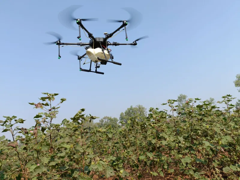
UAE geospatial firms have spent years integrating unmanned aerial vehicle (UAV) data streams with satellite imagery and ground-sensor networks to create unified crop health dashboards. The drone protocols they developed for monitoring date palm plantations — which require precise canopy-level analysis to detect early-stage disease and water stress — transfer remarkably well to row crops.
A California Central Valley almond producer began using a UAE-origin drone integration platform in 2023. Within two growing cycles, the operation had reduced its fungicide applications by 18 percent by identifying infection vectors earlier than its previous monitoring regime allowed. The platform's alert system, which flags anomalies in near-infrared reflectance data within hours of a drone pass, gave the farm's management team a response window that had previously not existed.
3. Predictive Irrigation Scheduling Using Real-Time Location Intelligence
Water management is where UAE geospatial expertise is perhaps most directly applicable to American agriculture. Predictive irrigation tools developed in the Emirates combine satellite-derived evapotranspiration estimates, localized weather modeling, and soil moisture sensor data to generate field-specific irrigation schedules updated on a 24-hour cycle.
A Texas cotton operation spanning roughly 8,000 acres integrated one such platform ahead of the 2024 growing season. End-of-season analysis showed a 31 percent reduction in total water applied compared to the preceding three-year average, with no statistically significant yield differential. In a state where groundwater depletion from the Ogallala Aquifer is an existential agricultural concern, that kind of efficiency gain carries implications well beyond a single farm's balance sheet.
4. Geofenced Yield Attribution and Logistics Optimization
Beyond the field itself, UAE location intelligence platforms are being applied to the agricultural supply chain. Geofenced zone mapping — technology originally developed to manage logistics across the UAE's sprawling free trade zones — is being adapted to attribute yield data to specific field blocks, track harvested product from combine to elevator, and optimize truck routing across large farming operations.
One Kansas wheat cooperative reported that implementing a geofenced logistics layer reduced its harvest-period truck idle time by 27 percent, a figure that translates directly to fuel savings and reduced driver overtime costs.
5. Satellite-Derived Crop Insurance Verification
Perhaps the most commercially significant emerging application involves the insurance sector. UAE geospatial firms, working with agricultural reinsurers, have developed satellite-based crop loss verification protocols that can assess damage extent within 48 hours of a weather event — compared to the weeks that traditional adjuster-based processes require. Several U.S. agricultural insurance providers are currently in pilot programs with UAE platform providers to integrate these capabilities into their claims workflows.
What Adoption Looks Like in Practice
American agribusinesses approaching UAE geospatial platforms for the first time typically encounter a few consistent friction points: data integration with existing farm management software, calibration requirements for local soil and crop types, and the practical challenge of building internal analytical capacity to act on the outputs these platforms generate.
The firms that have navigated these challenges most successfully share a common characteristic: they treated the geospatial platform not as a plug-and-play product but as a data infrastructure investment requiring internal process adaptation. Those that expected immediate, turnkey results without operational adjustment generally reported less satisfying outcomes.
For agribusiness technology integrators and precision agriculture consultants advising American farm clients, the practical recommendation is straightforward: UAE geospatial platforms merit serious evaluation, but their value is unlocked through deliberate implementation rather than passive deployment.
The Bigger Picture
The adoption of UAE-built location intelligence tools by American farmers is, at one level, simply a story about effective technology finding receptive markets. But it also reflects a broader reorientation in the global geospatial industry — one in which innovation is no longer exclusively a product of Silicon Valley or European tech clusters.
For U.S. agribusiness, the practical question is not where these tools were built. It is whether they deliver measurable value in the field. Increasingly, the evidence suggests they do.